Koksijde: population and statistics
Koksijde has a population of 21,072 (2026) across 50.1 km², or 421 people per km². It ranks 160 of 565 municipalities by population. Its population is falling: −4.5% between 2016 and 2026.
- 21,072 residents
- 50.1 km²
- 421 people/km²
- 0 m

Key points
Among the 62 municipalities in West Flanders, Koksijde ranks No. 17 by population.
Share of inhabitants aged 65 and over: 46.5% in Koksijde, compared with an average of 25.3% in West Flanders and 20.7% nationally.
New dwellings authorised per year per 1,000 inhabitants: 16.05 ‰ inh. in Koksijde, compared with an average of 7.30 ‰ inh. in West Flanders and 4.28 ‰ inh. nationally.
Largest business sector: Professional, scientific and technical, with 24.2% of the area's businesses.
A 1 kWp solar panel tilted at 40° generates about 1,118 kWh a year here.
Did you know?
- Number 1 in West Flanders for “Share of inhabitants aged 65 and over”.
- “Share of inhabitants aged 65 and over”: higher than in 99% of municipalities.
- “New dwellings authorised per year per 1,000 inhabitants”: higher than in 99% of municipalities.
- “Net taxable income per inhabitant”: higher than in 99% of municipalities.
- Its area is roughly equal to 7,015 football pitches.
- The nearest municipality is Veurne, 3.2 km away.
- The nearest more populous municipality is Ostend (73,000 residents), 23 km away.
Koksijde in numbers
All indicators for Koksijde
Value for the municipality, then the regional average and the national median (for counts: regional and national totals). The gauge places the municipality between the lowest and highest value in the country.
Population
| Indicator | Koksijde | West Flanders | National | Position | Rank |
|---|---|---|---|---|---|
| Share of inhabitants aged 65 and over (2026) | 46.5% | 25.3% | 21.7% | ranked 1 of 564 | |
| Share of inhabitants under 20 (2026) | 10.4% | 19.9% | 21.5% | ranked 564 of 564 |
Housing
| Indicator | Koksijde | West Flanders | National | Position | Rank |
|---|---|---|---|---|---|
| Buildings built before 1946 (2024) | 17.3% | – | 34.6% | ranked 485 of 564 | |
| Buildings built after 2001 (2024) | 14.5% | – | 15.3% | ranked 319 of 564 | |
| Share of houses in the building stock (2024) | 64.5% | – | 79.9% | ranked 534 of 564 | |
| Number of dwellings (2024) | 30,758 | 736,010 | 5,783,434 | ranked 29 of 565 | |
| New dwellings authorised per year per 1,000 inhabitants (2021-2025) | 16.05 ‰ inh. | 7.30 ‰ inh. | 4.39 ‰ inh. | ranked 3 of 564 |
Energy
| Indicator | Koksijde | West Flanders | National | Position | Rank |
|---|---|---|---|---|---|
| Residential buildings with central heating or air conditioning (2024) | 77.6% | – | 76.7% | ranked 264 of 564 |
Economy
| Indicator | Koksijde | West Flanders | National | Position | Rank |
|---|---|---|---|---|---|
| VAT-liable enterprises (2024) | 2,675 | 148,653 | 1,170,010 | ranked 112 of 565 | |
| VAT-liable enterprises per 1,000 inhabitants (2024) | 126.9 ‰ inh. | 120.3 ‰ inh. | 102.2 ‰ inh. | ranked 88 of 564 | |
| Net taxable income per inhabitant (2023) | 32,288 € | 24,427 € | 24,247 € | ranked 7 of 564 | |
| Median disposable income (administrative) (2023) | 30,111 € | – | 30,830 € | ranked 347 of 551 | |
| Median selling price of houses (2025) | 447,000 € | – | 302,500 € | ranked 52 of 554 | |
| Median selling price of apartments (2025) | 265,000 € | – | 249,900 € | ranked 112 of 299 |
Transport
| Indicator | Koksijde | West Flanders | National | Position | Rank |
|---|---|---|---|---|---|
| Cars per household (2025) | 1.07 | 1.11 | 1.25 | ranked 481 of 564 | |
| Households without a car (2025) | 24.8% | 23.1% | 17.6% | ranked 84 of 564 |
Society
| Indicator | Koksijde | West Flanders | National | Position | Rank |
|---|---|---|---|---|---|
| Share of inhabitants of foreign nationality (2026) | 4.0% | 7.6% | 6.4% | ranked 454 of 564 | |
| Administrative poverty risk (2023) | 7.3% | 6.8% | 7.0% | ranked 257 of 551 |
Population of Koksijde over time
Koksijde had 22,074 residents in 2016 and 21,072 in 2026.
| Year | Population |
|---|---|
| 2021 | 21,852 |
| 2022 | 21,851 |
| 2023 | 21,664 |
| 2024 | 21,546 |
| 2025 | 21,344 |
| 2026 | 21,072 |
Where is Koksijde?
Business sectors: Koksijde
Share of each sector in total businesses; “×1.5” means the sector is 1.5 times more common than nationally.
- Professional, scientific and technical24.2% ×1.2
- Wholesale and retail trade16.0% ×1.1
- Accommodation and food services10.8% ×2.0
- Construction8.0% ×0.6
- Real estate8.0% ×2.6
- Health and social work5.8% ×1.3
- Administrative and support services5.6% ×0.9
- Other service activities5.3% ×0.8
Sunshine and temperatures: Koksijde
Frequently asked questions
What is the population of Koksijde?
Koksijde has 21,072 residents (2026), ranking 160 of 565 municipalities.
How big is Koksijde?
Koksijde covers 50.1 km², with a density of 421 people per km².
Is the population of Koksijde growing?
Between 2016 and 2026, the population of Koksijde went from 22,074 to 21,072, a change of −4.5%.
Where is Koksijde?
Koksijde is in West Flanders. It belongs to Veurne (arrondissement). Latitude 51.100, longitude 2.650.
Share of inhabitants aged 65 and over: what is the figure for Koksijde?
In Koksijde, “Share of inhabitants aged 65 and over” stands at 46.5% (2026), ranking 1 of 564 municipalities; the national median is 21.7%.
New dwellings authorised per year per 1,000 inhabitants: what is the figure for Koksijde?
In Koksijde, “New dwellings authorised per year per 1,000 inhabitants” stands at 16.05 ‰ inh. (2021-2025), ranking 3 of 564 municipalities; the national median is 4.39 ‰ inh..
How much electricity does a solar panel produce in Koksijde?
In Koksijde, a 1 kWp south-facing system tilted at 40° produces about 1,118 kWh a year.
Which municipalities border Koksijde?
The nearest to Koksijde are Veurne (3.2 km), De Panne (4.1 km), Nieuwpoort (7.8 km), Alveringem (11 km), Lo-Reninge (15 km).
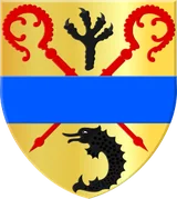
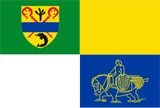
Coat of arms: rode raaf, Public domain, Wikimedia Commons · Flag: unknown, SVG = own work, Public domain, Wikimedia Commons. Coats of arms and flags are shown for identification only; this site is not affiliated with any public authority.

